

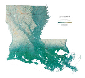
The gentle rolling landscape shown on the Louisiana map is a result of years of clays and silt being deposited by the Mississippi River. Remarkable Lake Pontchartrain is the largest estuary in southern Louisiana.
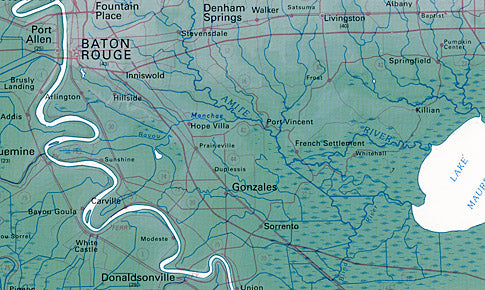
All of our state wall maps display an incredible amount of detail, from cities, highways, and mountain ranges, to valleys, rivers, and small towns. Louisiana map elevations are represented by color, and this, in combination with our relief shading technique, gives the map a lush, 3-dimensional look.
Louisiana Map Dimensions: 41" x 45"
Louisiana Map Scale: 1:500,000 (1" = about 8 miles)
by Raven Maps