

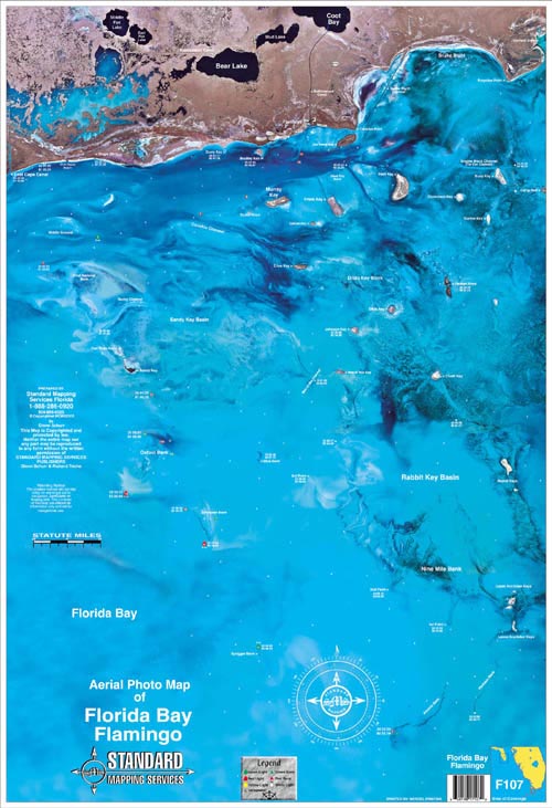
Florida Bay Flamingo Florida Aerial/Satellite Chart F107
This satellite aerial photo map is the perfect tool for the fisherman or outdoor enthusiast. The high resolution satellite photo map allows the inshore fisherman to see more accurate detail and hidden spots than that of a traditional navigation chart. Backwater areas come alive in this map. Get to places most people don't know about! Flamingo, Sandy Key Basin, Whipray Basin, Snake Bight and Rabbit Key Basin are all covered in this aerial photo map.
Full color laminated aerial photo map, approx. 22"x 34".