

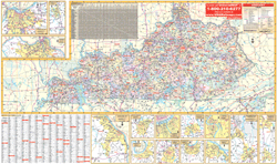
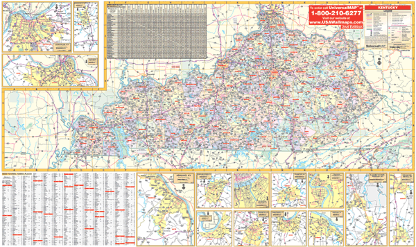
The 3rd edition Kentucky Wall Map measures 66" W x 42" H and includes the following information: all state highways, federal highways, secondary roads, major waterways, airports, state and national parks, towns, state universities, military installations, and points of interest.
Inset maps as follows: Ashland, Bowling Green, Covington, Elizabethtown, Frankfort, Henderson, Louisville, Owen, Owensboro, Radcliff, Richmond, and Northern Kentucky. Special Features provided include: Color Coded Counties, and a Mileage Chart Between Major Cities. In addition, for your convenience, cities and counties are indexed on the face of the map.
The map is protected with a laminate finish, which is both markable and washable. Framing rails are included on top and bottom for easy wall mounting.